Updates via Twitter

Inspired by the KPBS Twitter feed, I’ve set my phone up to be able to send updates via my twitter feed, just in case I have to evacuate again: twitter.com/getjazzed

Air National Guard is sending fire fighting teams from Wyoming and North Carolina to Southern California. The official request paperwork will not be officially official until Tuesday, but they are en route now, calling it a training exercise until that happens.

Navy helicopters are now dropping water on some parts of the fire.

Witch Fire Monday Afternoon Update

For the benefit of those we know in other parts of the country and other parts of the world, we are still safe. Areas of San Diego that were previously thought safe are now being evacuated. Specifically, Scripts Ranch (where a lot of homes burned during the Cedar fire) is being evacuated. This area was thought to be safe earlier today. If the fire goes through Scripts Ranch, there is a good chance we will have to leave Mira Mesa. Just heard on the news that two thirds of the population of San Diego county has now been evacuated.

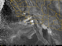
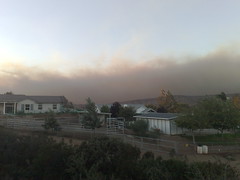
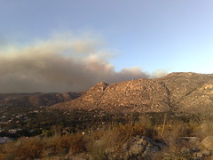
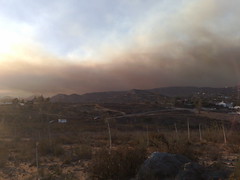
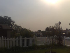
Right now there is a good breeze here in Mira Mesa, but no really strong winds at the moment. Near us, there is not as much ash in the air as there was this morning. Currently the fires are north of us in Del Dios, where a mandatory evacuation is underway, and east of us in Poway (the east side near Ramona), where evacuations have started. There are a few more photos taken from Mira Mesa earlier today now on Flickr:

A lot of smokey haze to the east

Ash in the pool

Winds are expected to decrease a bit overnight, but remain strong. Here are a couple more local references sites, for those outside the area:

I have spoken to Suzanne in Belarus. She has no access to mass media, so didn’t know anything about the fires here. She is doing okay there, and is anxious to get home later this week. Thanks for all the calls. I even received a call from family in France a little while ago. Wish we were famous for another reason right now.

Satellite Image of So Cal Fires

View of Southern California from the National Weather Service satellite. A little different perspective from what is being shown on the news. Click on image for latest shot from the National Weather Service

National Weather Service satellite image of Southern California

The fire has made its way into northern San Diego, burning homes in Rancho Bernardo. Our area of Ramona is basically untouched as of Monday morning, according to sources in the area. I am currently logged in to a server that is still up in our house, so we haven’t even lost power there.

Evacuated due to Witch fire

I didn’t think we would have to evacuate, but around 9:30pm I got the “reverse 911” call. I grabbed a few critical belongings, a few days worth of clothes and a bag of dog food. It didn’t take any convincing to get Django into the car, and we headed out. I had already staged everything by the door, just in case. It took over three hours to get out of the area with everyone trying to leave at the same time, all 36,000 of us.

SignOnSanDiego.com has a fire blog with continuous updates. I’m here to say the fire was farther south than they show on the Witch fire perimeter map (pdf) at 11pm. I saw the flames as I was leaving.